Translate this blog

Thursday, February 17, 2022

Lunchtime Talks on EXtreme Climate: Water & Climate Information Services for Society

On Tuesday, the 8th of February, I delivered a lecture which is part of a series of Lunchtime Talks of the EXtremeClimTwin project.
 
I talked about Water and Climate Information Services for Society in a group of Early Stage Researchers, scientists and enthusiasts on climate information services and the importance of integrating user- and data-driven approaches for services co-design to benefit society at all scales.
 
Do you want to know more? See the full video below! 


Thursday, September 2, 2021

Weather and Information Services for agricultural adaptation


Smallholder farmers in developing countries are one of the populations most vulnerable to climate variability and extreme events. Climate Information Services (CIS) are increasingly regarded as an important option for agricultural adaptation. CIS compiles climate and weather information, translates it into user-friendly products and supports farmers’ decision-making. It is crucial to understand how to develop effective CIS and the extent to which farmers will accept it.


Spyridon Paparrizos of Wageningen University & Research, the Netherlands, and colleagues initiated the WATERAPPS project and co-developed it with farmers in Khulna District, Bangladesh, to build resilience to climate variability. Furthermore, the researchers examine the farmer’ willingness to pay (WTP) for CIS. With the contingent valuation method, they find that local farmers are willing to pay 971–1,387 taka (1 USD = 85 taka). Notably, farmers previously exposed to CIS development and training are more willing to pay for such products. The researchers suggest that the government and private and social entrepreneurs should all actively work with farmers to improve their capacity to better use CIS. They will upscale the services so that they are available to all of Bangladesh.


Citation: Yan, L. Information Services. Nat. Clim. Chang. 11, 719 (2021). https://doi.org/10.1038/s41558-021-01144-0

 Read more at: https://www.nature.com/articles/s41558-021-01144-0


Original citation: Paparrizos, S., Kumar, U., Amjath-Babu, T.S. & Ludwig, F. 2021. Are farmers willing to pay for participatory climate information services? Insights from a case study in peri-urban Khulna, Bangladesh. Climate Services, 23, 100241.


Friday, February 22, 2019

Modeling global wetland methane emissions

While anthropogenic methane emissions represent 2/3 of the global total annual emissions, the rest 1/3 constitute natural emissions, are dominated by natural wetlands and significantly vary from year to year depending highly on various climatological parameters.

Currently, process-based models are used to compute wetland extent and CH4 wetland fluxes based on soil carbon content, soil temperature, humidity, etc. but they can be time consuming and may require significant calibration effort.

We substitute these process-based models by a statistical model that can be easily implemented, operates efficiently, and reduces significantly the computation time using novel Machine Learning algorithms.

We tested various machine learning (ML) algorithms (fast-forward multi-linear regression, random forest) to develop a statistical algorithm to compute wetland methane emissions based on an ensemble of predictors. 

The algorithm is trained per Plant Functional Type and Koeppen-Geiger climate classification type (PFT+KG) using as dependent variable daily and monthly CH4 wetland emissions produced by ORCHIDEE-WET, while the explanatory (independent) climatological variables are obtained from the ERA5 climate re-analysis dataset. 


Statistical evaluation criteria such as the Root Mean Squared Error (RMSE), and Mean Squared Deviation (MSD) that were implemented to evaluate model performance showed that the results from different ML algorithms present very good correlation each time during global modelling and specifically the random forest (RF) approach was able to simulate the results with great efficiency while operating on a daily timestep (R2 > 0.95). 


Although the linear regression (MLR) approach showed very good correlation in higher northern latitudes (R2 > 0.96), it presents some discrepancies for the tropics (R2 > 0.88), where more complex approaches are required to simulate wetland methane emissions and are mainly captured by the random forest approach. 


Soil temperature is the main driver for higher northern latitudes, while for the tropics and southern high latitudes soil moisture and surface pressure mostly affect the production of wetland methane emissions. 


Tuesday, December 20, 2016

2017 Climate Journal Travel Award for Young Scientists


'I want to thank Climate Journal for giving me the possibility first of all to present my work, and it will be an honor for me to mention the Climate Journal during my presentation in the 17th European Meteorological Society Annual Meeting and the 12th European Conference on Applied Climatology that will be held in Dublin, Ireland during 4-8 September, 2017.' 

 Full description of the Award can be found in Climate Journal.

Tuesday, November 29, 2016

New Publication: A downscaling technique for climatological data in areas with complex topography and limited data


Η εργασία με τίτλο: 'A downscaling technique for climatological data in areas with complex topography and limited data' δημοσιεύτηκε στο διεθνές επιστημονικό περιοδικό International Journal of Engineering Research and Development

 Paparrizos, S., Maris, F. & Matzarakis, A., 2016. A downscaling technique for climatological data in areas with complex topography and limited data, International Journal of Engineering Research and Development, 12(11), 17-23. 

 Τη δημοσίευση μπορείτε να τη βρείτε εδώ.

Tuesday, October 25, 2016

New Publication: Assessment of future climate change impacts on the hydrological regime of selected Greek areas with different climate conditions


Η εργασία με τίτλο: 'Assessment of future climate change impacts on the hydrological regime of selected Greek areas with different climate conditions' δημοσιεύτηκε στο διεθνές επιστημονικό περιοδικό Hydrology Research

 Paparrizos, S., & Matzarakis, A., 2016. Assessment of future climate change impacts on the hydrological regime of selected Greek areas with different climate conditions, Hydrology Research, DOI: 10.2166/nh.2016.018 

 Τη δημοσίευση μπορείτε να τη βρείτε εδώ.

New Publication: Present and future assessment of growing degree days over selected Greek areas with different climate conditions


Η εργασία με τίτλο: 'Present and future assessment of growing degree days over selected Greek areas with different climate conditions' δημοσιεύτηκε στο διεθνές επιστημονικό περιοδικό Meteorology and Atmospheric Physics

Paparrizos, S., & Matzarakis, A., 2016. Present and future assessment of growing degree days over selected Greek areas with different climate conditions, DOI: 10.1007/s00703-016-475-8 

 Τη δημοσίευση μπορείτε να τη βρείτε εδώ.

New Publication: Analysis and mapping of present and future response drought conditions over Greek areas with different climate conditions


Η εργασία με τίτλο: 'Analysis and mapping of present and future response drought conditions over Greek areas with different climate conditions' δημοσιεύτηκε στο διεθνές επιστημονικό περιοδικό Theoretical and Applied Climatology

 Paparrizos, S., Maris, F., Weiler, M., & Matzarakis, A., 2016. Analysis and mapping of present and future response drought conditions over Greek areas with different climate conditions, DOI: 10/1007/s00704-016-1964-x 

 Τη δημοσίευση μπορείτε να τη βρείτε εδώ.

Thursday, October 29, 2015

New Publication: Integrated analysis of present and futre response of precipitation over selected Greek areas with different climate conditions


Η εργασία με τίτλο: 'Integrated analysis of present and futre response of precipitation over selected Greek areas with different climate conditions' δημοσιεύτηκε στο διεθνές επιστημονικό περιοδικό Atmospheric Research

Paparrizos, S., Maris, F., & Matzarakis, A., 2015. Integrated analysis of present and future response of precipitation over selected areas with different climate conditions, Atmospheric Research, 169, 199-208, DOI: 10.1016/j.atmosres.2015.10.004 

 Τη δημοσίευση μπορείτε να τη βρείτε εδώ.

Monday, May 4, 2015

Διαλέξεις στο Μεταπτυχιακό Πρόγραμμα Σπουδών ΔΔΠΦΠ - 08/05/2015 - Παπαρρίζος Σπυρίδων


Πρόγραμμα Διαλέξεων, 8/5/2015, ώρα 19:00 - 21:00, Εργαστήριο Διευθέτησης Ορεινών Υδάτων και Διαχείρισης Κινδύνου, Ορεστιάδα. 

 1. Εισαγωγή στην εφαρμοσμένη Υδρομετεωρολογία 

 2. Ολοκληρωμένη ανάλυση και χαρτογράφηση της ξηρασίας για επιλεγμένες περιοχές της Ελλάδας με διαφορετικές κλιματικές συνθήκες  

3. Ανάλυση ευαισθησίας και σύγκριση διαφόρων μεθόδων υπολογισμού δυνητικής εξατμισοδιαπνοής για επιλεγμένες περιοχές της Ελλάδας 

  1. Εισαγωγή στην εφαρμοσμένη Υδρομετεωρολογία 

Διάρκεια: 30' 

 Περίληψη: Γενικές έννοιες και ορισμοί. Υδρολογία, μετεωρολογία, καιρός, κλιματολογία, κλίμα, ατμοσφαιρικές επιστήμες. Κύριοι κλάδοι ατμοσφαιρικών επιστημών, φυσική μετεωρολογία, συνοπτική μετεωρολογία, δυναμική μετεωρολογία, φυσική κλιματολογία, κλιματογραφία, εφαρμοσμένη κλιματολογία. Υδρομετεωρολογία, διεργασίες που αφορούν την υδρομετεωρολογία, σύντομο ιστορικό. Τύποι μετρήσεων, δίκτυα μετεωρολογικών σταθμών και μετεωρολογικών δορυφόρων. Ενεργειακό ισοζύγιο της γης. Υδρολογικό ισοζύγιο. Υδρολογικός κύκλος και ποσοτική έκφρασή του. παρουσία νερού στη γη. Χαρακτηριστικές χρονικές κλίμακες μέτρησης. Χωρικές κλίμακες μέτρησης, λεκάνη απορροής, υδατικά διαμερίσματα Ελλάδας. Χωρικές κλίμακες μετεωρολογίας. 

2. Ολοκληρωμένη ανάλυση και χαρτογράφηση της ξηρασίας για επιλεγμένες περιοχές της Ελλάδας με διαφορετικές κλιματικές συνθήκες 

Διάρκεια: 60' 

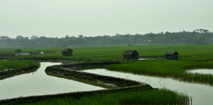
 Περίληψη: Κλιματική αλλαγή, ξηρασία, ορισμοί, αιτίες. Δείκτες ξηρασίας, επιλογή δείκτη ξηρασίας. Επιπτώσεις ξηρασίας. Ξηρασία & Διαχείριση Υδάτινων Πόρων. Ολοκληρωμένη ανάλυση ξηρασίας. Παράδειγμα εφαρμογής σε 3 λεκάνες απορροής της Ελλάδας. Ξηρασία και γεωργική παραγωγή. Άρδευση. Σχετική συχνότητα, διάρκεια, ένταση, τάση και χωρική κατανομή συνθηκών ξηρασίας. Πολυ-γραμμική παλινδρόμηση. Χωρική παρεμβολή, Ordinary Kriging. Αποτελέσματα ολοκληρωμένης ανάλυσης συνθηκών ξηρασίας. Συμπεράσματα, συζήτηση, μελλοντικές προτάσεις. Σύγκριση με παρόμοιες μελέτες. Ρόλος επιστήμης διαχείρισης ορεινών υδάτινων πόρων, υδρομετεωρολογίας και κλιματολογίας σε σχέση με τις επιπτώσεις της αλλαγής του κλίματος. 

3. Ανάλυση ευαισθησίας και σύγκριση διαφόρων μεθόδων υπολογισμού δυνητικής εξατμισοδιαπνοής για επιλεγμένες περιοχές της Ελλάδας 

Διάρκεια: 30' 

 Περίληψη: Επισκόπηση, εξατμισοδιαπνοή, δυνητική εξατμισοδιαπνοή, τρόποι μέτρησης & υπολογισμού εξατμισοδιαπνοής, χρησιμότητα γνώσης. Άρδευση & εξατμισοδιαπνοή, προγραμματισμός διαθέσιμων υδατικών πόρων. Εμπειρικές μέθοδοι υπολογισμού εξατμισοδιαπνοής. Ανάλυση ευαισθησίας (sensitivity analysis). Προσδιορισμός μεθόδων εξατμισοδιαπνοής. Καθορισμός διαδικασίας ανάλυσης ευαισθησίας. συντελεστής ευαισθησίας, πλεονεκτήματα επιλογής συντελεστή. Εφαρμογή ανάλυσης ευαισθησίας στις εξισώσεις υπολογισμού της εξατμισοδιαπνοής. Ανάλυση αποτελεσμάτων. Συμπεράσματα, μετεωρολογικοί παράγοντες που επηρεάζουν τον υπολογισμό της εξατμισοδιαπνοής.

Tuesday, April 7, 2015

New Publication: ''Hydrological simulation of Sperchios River basin in Central Greece using the MIKE SHE model and geographic information systems''


Η εργασία με τίτλο: ''Hydrological simulation of Sperchios River basin in Central Greece using the MIKE SHE model and geographic information systems'' δημοσιεύτηκε στο διεθνές περιοδικό Applied Water Science. 

 Paparrizos S. & Maris F., 2015. Hydrological simulation of Sperchios River basin in Central Greece using the MIKE SHE model and geographic information systems, Applied Water Science, DOI 10.1007/s13201-015-0271-5 

 Τη δημοσίευση μπορείτε να την βρείτε εδώ.

Tuesday, January 20, 2015

Νέα Δημοσίευση: ''Spatial Data Infrastructures (SDIs) in Greece; An assessment of geoportals for carrying out hydrological projects


Η εργασία με τίτλο: ''SPATIAL DATA INFRASTRUCUTRES (SDIs) IN GREECE; AN ASSESSMENT OF GEOPORTALS FOR CARRYING OUT HYDROLOGICAL PROJECTS'' δημοσιεύτηκε στο περιοδικό International Water Technology Journal

 Paparrizos S., Anastasiou Th., Maris F., Kitikidou K. and Potouridis S., 2014. Spatial data Infrastructures (SDIs) in Greece; An assessment of geoportals for carrying out hydrological projects, International Water Technology Journal 4(4), 222-232.

Τη δημοσίευση μπορείτε να την βρείτε εδώ.

  ABSTRACT 

 The role of Spatial Data Infrastructures (SDIs) plays a very important part in improving electronic governance in Greece. Following the INSPIRE Directive, the European Parliament and Council for the creation of infrastructure for geospatial data in the European community began making slow but steady progress in 2007 in Greece towards creating geoportals that will meet the needs of those interested in acquiring geospatial information and data. In the current paper, a reference to geoportals providing the necessary geodata is provided concerning the completion of hydrological projects in Greece. A brief description of the framework conditions in Europe on this subject and an assessment of Greek geoportals are presented following scrutiny and the use of available geospatial data. Additionally, some suggestions are given for future improvements aimed at further development. In short, the current work reveals the need for collaboration between the existing geoportal providers in the creation of a common bank consisting of geospatial data and geo-information, where all the necessary geo-spatial data can be uploaded, verified and made available to potential users. 

 Keywords: Spatial Data Infrastructures (SDI), Geographic Information (GI), Geoportal, Geodata, Hydrology, Greece

Monday, August 4, 2014

Βιβλίο: Υδρογεωπληροφορική - Μοντελοποίηση και Πληροφοριακά Συστήματα Διαχείρισης Υδατικών Πόρων


Συγγραφείς: Φώτιος Μάρης, Σπυρίδων Παπαρρίζος, Γεώργιος Καρατζιός
Εκδόσεις Δισίγμα, Θεσσαλονίκη, ISBN: 978-960-9495-43-1

 Στόχος του παρόντος βιβλίου είναι να επικεντρωθεί στις πληροφορίες του νερού που προέρχονται από τις παρατηρήσεις της γης και τα λογισμικά, τα συστήματα και τις τεχνολογίες για τη βελτίωση της μοντελοποίησης των πληροφοριών για τους υδατικούς πόρους, την ανάλυση, την οπτικοποίηση και την κοινή χρήση τους. 

Απευθύνεται κυρίως στους προπτυχιακούς και μεταπτυχιακούς φοιτητές που διδάσκονται το μάθημα της υδρογεωπληροφορικής καθώς και σε επιστήμονες που αναζητούν στοχεμένες λύσεις στα προβλήματα της υδρολογίας, της υδραυλικής και περιβαλλοντικής μηχανικής για την αειφορική διαχείριση των υδάτων με τη χρήση μοντέλων προσομοίωσης και πληροφορικής. 

Οι αναγνώστες θα εξοικειωθούν με τα μοντέλα που εφαρμόζονται σε συστήματα με βάση το νερό, θα αναπτύξουν βασικές δεξιότητες και ικανότητες στην διαχείριση των υδάτων χρησιμοποιώντας τα σημαντικότερα υδρολογικά μοντέλα αξιοποιώντας τα γεωγραφικά συστήματα πληροφοριών καθώς και διάφορα συστήματα πληροφόρησης και στήριξης αποφάσεων. 

Περισσότερες πληροφορίες για το βιβλίο μπορείτε να βρείτε εδώ

Wednesday, June 11, 2014

Ομιλία του καθηγητή Βιομετεωρολογίας του Freiburg University Dr. Ματζαράκη Ανδρέα στην Ορεστιάδα 13 Ιουνίου 2014


Την Παρασκευή 13/06/2014 στις 11:00 θα πραγματοποιηθεί ομιλία του Δρ. Ματζαράκη Ανδρέα Καθηγητή Βιομετεωρολογίας του πανεπιστημίου του Freiburg Γερμανίας, στο αμφιθέατρο Δασολογίας και Διαχείρισης Περιβάλλοντος και Φυσικών Πόρων του Δημοκριτείου Πανεπιστημίου Θράκης, με θέμα: "Αστικό κλίμα και βιοκλίμα για αστικό σχεδιασμό - Κλιματική αλλαγή και πόλεις"

Friday, June 6, 2014

To Google Street View στην Ελλάδα!


Το πασίγνωστο βανάκι της Google βρέθηκε και στην Ελλάδα και κατέγραψε τις γειτονιές μας! Όπως έχει γίνει σε πολλές χώρες και πόλεις του εξωτερικού, η συγκεκριμένη υπηρεσία είναι πλέον διαθέσιμη και για τη χώρα μας! Κάποιοι θα πούνε ότι μας παρακολουθούν, εγώ προσωπικά χαίρομαι γιατί μπορώ να δω από χιλιάδες χιλιόμετρα μακριά το σπιτάκι μου! Πατήστε στον παρακάτω σύνδεσμο, πάρτε το πορτοκαλί ανθρωπάκι κάτω δεξιά δίπλα από την εξερεύνηση, σύρτε το πάνω στον χάρτη και ξεκινήστε τις ψηφιακές βόλτες σας λοιπόν!

-->   Καλές βόλτες!  <--

Wednesday, June 4, 2014

5 Ιουνίου - Παγκόσμια Ημέρα Περιβάλλοντος


 Η Παγκόσμια Ημέρα Περιβάλλοντος γιορτάζεται κάθε χρόνο στις 5 Ιουνίου και αποτελεί το κύριο όχημα του ΟΗΕ από το 1972 για την ενημέρωση του κοινού σχετικά με κρίσιμα περιβαλλοντικά προβλήματα. 

Παρά τις προσπάθειες ακτιβιστών για την προστασία της φύσης και τη διατήρηση της βιοποικιλότητας, η διεθνής κοινότητα εμφανίζεται απρόθυμη να προχωρήσει στη λήψη ουσιαστικών μέτρων και στην υιοθέτηση μιας αναπτυξιακής πολιτικής που δεν θα είναι εις βάρος του περιβάλλοντος. Το φαινόμενο του θερμοκηπίου και το λιώσιμο των πάγων στους πόλους είναι ορισμένα μόνο από τα προβλήματα που απαιτούν άμεση επίλυση.

Monday, May 5, 2014

Νέα Δημοσίευση: Regional hazard analysis for use in vulnerability and risk assessment

 
 Η εργασία (Poster) όπως παρουσιάστηκε στο συνέδριο της European Geosciences Union στη Βιέννη, 29 Απριλίου 2014 με τίτλο Regional hazard analysis for use in vulnerability and risk assessment

FOTIOS MARIS1, KYRIAKI KITIKIDOU1, SPYRIDON PAPARRIZOS2, KONSTANTINOS KARAGIORGOS3, SIMEON POTOURIDIS1, SVEN FUCHS3 

1 Department of Forestry and Management of the Environment and Natural Resources Democritus University of Thrace, Pantazidou str. 192, GR-68 200, Orestiada, Greece 
2 Chair of Meteorology and Climatology, Albert-Ludwigs University Freiburg, Werthmannstr 10, D-79085, Freiburg, Germany 
3 University of Natural Resources and Life Sciences, Institute of Mountain Risk Engineering, Vienna, Austria  

ABSTRACT A method for supporting an operational regional risk and vulnerability analysis for hydrological hazards is suggested and applied in the Island of Cyprus. The method aggregates the output of a hydrological flow model forced by observed temperatures and precipitations, with observed discharge data. A scheme supported by observed discharge is applied for model calibration. A comparison of different calibration schemes indicated that the same model parameters can be used for the entire country. In addition, it was demonstrated that, for operational purposes, it is sufficient to rely on a few stations. Model parameters were adjusted to account for land use and thus for vulnerability of elements at risk by comparing observed and simulated flow patterns, using all components of the hydrological model. The results can be used for regional risk and vulnerability analysis in order to increase the resilience of the affected population. 

KEYWORDS: Natural hazards, Vulnerability, Risk assessment 

Την Δημοσίευση μπορείτε επίσης να την βρείτε στην Ενότητα Publications

Friday, January 3, 2014

Νέα Δημοσίευση: ESTIMATION AND COMPARISON OF POTENTIAL EVAPOTRANSPIRATION BASED ON DAILY AND MONTHLY DATA FROM SPERCHIOS VALLEY IN CENTRAL GREECE

Έγινε δεκτή μετά από κρίση για δημοσίευση στο GLOBAL NEST Journal (IF=0.698) το Paper με τίτλο ESTIMATION AND COMPARISON OF POTENTIAL EVAPOTRANSPIRATION BASED ON DAILY AND MONTHLY DATA FROM SPERCHIOS VALLEY IN CENTRAL GREECE

SPYRIDON PAPARRIZOS1*, FOTIOS MARIS2, ANDREAS MATZARAKIS1 

Chair of Meteorology and Climatology, Albert-Ludwigs University Freiburg, Werthmannstr 10, D-79085, Freiburg, Germany 
Department of Forestry and Management of the Environment and Natural Resources Democritus University of Thrace, Pantazidou str. 192, GR-68 200, Orestiada, Greece 

 ABSTRACT There is no golden rule concerning the optimal equations to estimate reference potential evapotranspiration (PETref) under various climates because even in the same climatic type, different studies have produced mixed results in relation to the performance of the empirical PETref equations. Knowledge of reference potential evapotranspiration (PETref) conditions is important for a number of vegetation and hydrological related applications. Direct estimations of PETref are difficult and require sophisticated instrumentation and methods. The equations of estimating potential evapotranspiration require several meteorological variables (e.g. solar radiation, wind speed), which most of the times are rarely available in daily values for the Greek meteorological stations. In the current research there is an attempt to estimate the potential evapotranspiration with EmPEst software which includes 13 different approaches, using daily and monthly data of the meteorological station of Lamia which is located within Sperchios river valley in central Greece. Finally, by the use of the statistical indicators that occur as an output from the software, there is a comparison and analysis of the exported results. The differentiations of the results showed which PET methods and series data (daily - monthly) were more suitable for the estimation of PET in the area of research. 

 KEYWORDS: PET, EmPEst, meteorological data, Sperchios, Greece

Την Δημοσίευση μπορείτε επίσης να την βρείτε στην Ενότητα Publications

Monday, November 25, 2013

Amazing Video: Hydrophobic coating!


 Εκπληκτικό "υδροφοβικό" υλικό που θα μπορούσε να υπάρχει στην καθημερινότητά μας και να μας κάνει τη ζωή... πολύ εύκολη!

Saturday, November 23, 2013

Νέα Δημοσίευση: STREAM FLOW QUANTILE REGRESSION MODELLING USING LAND USE INFORMATION IN THE SPERCHIOS RIVER BASIN (CENTRAL GREECE)

Έγινε δεκτή μετά από κρίση για δημοσίευση στο Carpathial Journal of Earth and Environmental Sciences (IF=1.495) το Paper με τίτλο STREAM FLOW QUANTILE REGRESSION MODELLING USING LAND USE INFORMATION IN THE SPERCHIOS RIVER BASIN (CENTRAL GREECE) 

Fotios MARIS, Kyriaki KITIKIDOU, Spyridon PAPARRIZOS & Simeon POTOURIDIS 
Department of Forestry & Management of the Environment and Natural Resources, Democritus University of Thrace, GR-68200 Orestiada, Greece. Corresponding author: Kyriaki Kitikidou 

STREAM FLOW QUANTILE REGRESSION MODELLING USING LAND USE INFORMATION IN THE SPERCHIOS RIVER BASIN (CENTRAL GREECE) 

Abstract: The estimation of flow in river basins is frequently required in hydrological practice and is of great economic significance. This study uses streamflow and catchment characteristic data, including land use information, from the Sperchios river basin (Central Greece) and applies quantile regression modelling. From 100% of the observations, 20% were selected randomly and used for independent testing of the quantile regression. The test observations and observations used for the model development were found to have similar characteristics. The quantile regression method generally provides accurate flow estimates; however, these techniques involve a chance of large errors under particular conditions, and provisions should be made accordingly. 

Keywords: flow estimation; land use; modelling; quantile regression


Την Δημοσίευση μπορείτε επίσης να την βρείτε στην Ενότητα Publications